


Voting District 43700, Contra Costa County, California
About
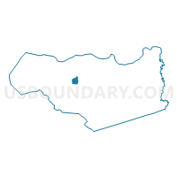
Outline

Summary
| Unique Area Identifier | 529349 |
| Name | Voting District 43700 |
| County | Contra Costa County |
| State | California |
| Area (square miles) | 2.66 |
| Land Area (square miles) | 2.66 |
| Water Area (square miles) | 0.00 |
| % of Land Area | 100.00 |
| % of Water Area | 0.00 |
| Latitude of the Internal Point | 37.94596870 |
| Longtitude of the Internal Point | -122.06645710 |
Maps


Graphs
Select a template below for downloading or customizing gragh for Voting District 43700, Contra Costa County, California


Neighbors
Neighoring Voting District (by Name) Neighboring Voting District on the Map
- Voting District 21675, Contra Costa County, CA
- Voting District 21680, Contra Costa County, CA
- Voting District 43410, Contra Costa County, CA
- Voting District 43435, Contra Costa County, CA
- Voting District 43445, Contra Costa County, CA
- Voting District 43645, Contra Costa County, CA
- Voting District 43655, Contra Costa County, CA
- Voting District 43660, Contra Costa County, CA
- Voting District 43710, Contra Costa County, CA
- Voting District 43720, Contra Costa County, CA
- Voting District 43725, Contra Costa County, CA
- Voting District 43825, Contra Costa County, CA
- Voting District 43830, Contra Costa County, CA
Top 10 Neighboring County Subdivision (by Population) Neighboring County Subdivision on the Map
Top 10 Neighboring Place (by Population) Neighboring Place on the Map
- Concord city, CA (122,067)
- Walnut Creek city, CA (64,173)
- Pleasant Hill city, CA (33,152)
- Contra Costa Centre CDP, CA (5,364)
Top 10 Neighboring Unified School District (by Population) Neighboring Unified School District on the Map
Top 10 Neighboring State Legislative District Lower Chamber (by Population) Neighboring State Legislative District Lower Chamber on the Map
- Assembly District 15, CA (591,194)
- Assembly District 14, CA (445,394)
- Assembly District 11, CA (445,356)
Top 10 Neighboring State Legislative District Upper Chamber (by Population) Neighboring State Legislative District Upper Chamber on the Map
Top 10 Neighboring 111th Congressional District (by Population) Neighboring 111th Congressional District on the Map
Top 10 Neighboring Census Tract (by Population) Neighboring Census Tract on the Map
- Census Tract 3270, Contra Costa County, CA (6,695)
- Census Tract 3220, Contra Costa County, CA (6,085)
- Census Tract 3400.01, Contra Costa County, CA (5,857)
- Census Tract 3250, Contra Costa County, CA (5,514)
- Census Tract 3240.02, Contra Costa County, CA (5,141)
- Census Tract 3381.01, Contra Costa County, CA (4,996)
- Census Tract 3240.01, Contra Costa County, CA (4,615)
- Census Tract 3382.03, Contra Costa County, CA (4,564)
- Census Tract 3230, Contra Costa County, CA (4,352)
- Census Tract 3362.01, Contra Costa County, CA (4,032)